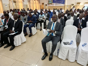
 Participants of the conference
Artificial intelligence has been identified as the new age for land surveying in the country.
In order to match global surveying, practitioners within the surveying space have been called upon to adopt the use of Artificial Intelligence (AI) in their practices to match modern advancements and improve the accuracy and competence of land surveying.
Delivering the keynote address during the 2024 Annual Land Surveyors Conference at the Capital View Hotel in Koforidua on Wednesday, August 21, 2024, Member of Parliament (MP) for Ahafo Ano South in the Ashanti Region, Surveyor Francis Manu-Adabor (MP) underscoring the need to adopt the technology observed that the future of land surveying in Ghana lies in the seamless integration of Geo AI, drone technology, open geospatial solutions, and other cutting-edge innovations.
The event held on the theme, “Revolutionizing Land Surveying: Unleashing the Power of Geospatial Artificial Intelligence (Geo AI) and Other Modern Techniques," within the Ghanaian context brought together various personalities within the land surveying field.
The conference discussed remarkable land surveying tools, techniques, and educational training—and how these advancements are revolutionizing modern mapping, managing, and planning the physical world, especially in Ghana.
Surveyor Francis Manu-Adabor, while identifying land surveying as a cornerstone of modern society, enabling infrastructure development, resource management, and environmental sustainability, said traditional methods face notable challenges such as accuracy, efficiency, and scalability.
According to him, geospatial AI and modern techniques are therefore required to transform the industry's landscape.
“For centuries, the practice of land surveying has progressed in lockstep with the development of measurement and mapping technologies. But equally important has been the evolution of land surveying education and professional development.
Geospatial AI combines artificial intelligence, machine learning, and geospatial data to revolutionize land surveying,” the MP said.
With the rapid advancements in geospatial technologies, the surveyor averred that innovations like high-resolution aerial and satellite imagery, light detection and ranging (LiDAR), and unmanned aerial vehicles (UAVs) or drones have radically transformed the approach to land surveying.
Keeping up with this technological revolution, the MP added, has required a dramatic shift in land surveying education.
“Today, aspiring professionals must not only master the fundamentals but also develop expertise in areas like remote sensing, GIS analysis, 3D modeling, and data science,” he said.
He asserted that the powerful intersection of AI, machine learning, and geospatial data is poised to revolutionize the field of land surveying in unprecedented ways, including geospatial AI, drones, satellite imaging, and other modern techniques that complement geospatial AI.
To prepare the next generation of land surveyors for the Geo AI-powered future, Surveyor Francis Manu-Adabor noted that educational institutions in Ghana are adapting their curricula to include coursework in programming, machine learning, and spatial analytics, adding that hands-on experience with Geo AI tools and techniques is becoming essential for aspiring professionals.
On his part, President of the Ghana Institution of Surveyors (GhIS), Surveyor Dr. Anthony Arko-Adjei, noted that emerging technologies were redefining the entire surveying profession and landscape.
He stated, “We stand at the threshold of a new era where the transformative potential of geospatial artificial intelligence and other technologies promises to revolutionize the way we collect, analyze, and utilize data, enabling us to deliver more accurate, efficient, and sustainable solutions.”
According to him, AI, virtual and augmented reality are now dictating the path of the land surveying profession, adding that professional land surveyors could not be left behind as the world moves towards technological advancement.
However, cautioning participants against key hurdles faced when integrating AI into the practice, surveyor Dr. Anthony Arko-Adjei identified falsifying survey data, perpetrating historical injustices, unethical use of spatial data, and outmoded regulatory frameworks that are unable to handle the nuances of AI-driven land surveying, creating uncertainty and potential liabilities.
Other dignitaries present included the Paramount Chief of the New Juaben Traditional Area, Nana Kwaku Boateng III, Executive Secretary of the Lands Commission, Director of Survey and Mapping Division at the Lands Commission, LiSAG President, FIG Vice President, amongst others.