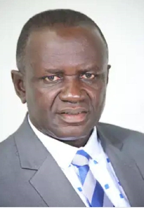
 Chairman for the Lands and Forestry Committee, Francis Manu-Adabor
The Member of Parliament for Ahafo Ano South East Constiuency, and Chairman for the Lands and Forestry Committee has said that it is time Ghana leverages on geospatial intelligence in fighting its galamsey menace and to support forest conservation for the future.
He was speaking at the launch of the Ghana Geospatial Society(GGS) in Accra. According to him, geospatial intelligence is cost effective because it uses technology, drones and satellite images to extract information about activities happening on the surface of the earth.
In his view geospatial intelligence provides authentic and reliable information backed by science and data, that can be used to solve the numerous dangers to the environment.
"We don't have to wait for the media to tell us where serious devastations like illegal mining, flood, bush fires and the likes are causing to our environment before we act. Geospatial intelligence can give us these information even in the hard to reach areas of our country" said Hon. Francis Manu-Adabor.
Geospatial intelligence is a discipline which work comprises of the exploitation and analysis of imagery and geospatial information to describe, assess, and visually depict physical features and geographically referenced activities on Earth.
The President of the Ghana Geospatial Society (GGS), Michael Nyoagbe believes his group will among other things standardize practice in the use or applcation of geospatial technology in Ghana.
"We are here to promote high standards of research, education, and training for geospatial-related programs in academic institutions and to facilitate continuing professional development of our members" he said.
The Ghana Geospatial Society is an umbrella body made up of various working professional groupings such as Geo-Social Sciences, Geo-Environment and Natural Resources, Geo-Surveying, Geospatial utilities and Engineering, Geospatial Information Technology, Geospatial Security, and Geo-Health, Science and Statistics.
The Chairman of the occasion and President of the Ghana Licensed Surveyors Association, Samuel Larbi Darko is optimistic that the GGS will foster the advancement of Geospatial Technology in creating job opportunities, education and training for its members.
"...the GGS will encourage the use of technology in strengthening government, private sector and academia while keeping its members duly informed on global advancement in geospatial activities" he added.
The vision of the Ghana Geospatial Society is to see to the advancement, practice, utilization and dissemination of all aspects of geospatial science, technology and their application in Ghana.
END.