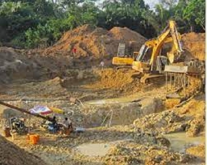
 File photo of a galamsey site
Environmental NGO, A Rocha Ghana has dismissed a recent claim by the Minister of Lands and Natural Resources that Ghana’s forest reserve remains intact.
Answering a specific question in Parliament on 23 February, on the State of Ghana’s Forest Reserves, Minister Samuel Jinapor submitted that he was satisfied with the management of Ghana’s forest reserves. But according to A Rocha Ghana, there is inconsistency with the publicly available information compared to the Minister's claims.
A statement by the NGO noted that, with the extensive damage from galamsey, illegal logging in some forest reserves yet to be restored, the statement by the Minister is farfetched.
It read in part: “The Minister stated that the ecological integrity of Ghana’s Forest Reserves has largely been maintained. This is a moot point. With the extensive damage from galamsey, clear felling and farming in some forest reserves yet to be restored, this statement is farfetched. Forest Reserves such as Krokosua, Sui River, Tano Suraw Extension, Afao Hills, Upper Wassaw, Anhwiaso West and East, Supuma Shelterbelt, Tano Offin, and Denyau Shelterbelt all appear to be lacking ecological integrity due to extensive damage. Further, in mid-January, forest sites Denyau Site 1,2 and 3, Supoma Site 1 and 2, Ntakem 1 and 2, and forest reserves of Numereso, Bepo Tintin, Kubi, Watreso, Adamso, Bunsu, Brechakrom, Amponuase, Apapraman, Hiayeya, Pomposo were all reported to be live galamsey sites.”
According to A Rocha, its checks on the ground revealed that the Forestry Commission is still struggling on a day-to-day basis to keep out illegal activities from the Forest Reserves, without any new logistical or operational support added to the existing set-up.
The Minister also reminded Parliament that the government has declared river bodies as RED ZONES for mining, referring to the President’s strict April 2021 ban on mining in or near water bodies as well as in Forest Reserves. But According to A Rocha Ghana, despite the ban, the Minerals Commission has given out several licences in 2022 and 2023 that straddle critical water bodies, including at the exact locations already decimated by galamsey.
The rivers include the Ankobra, Pra, Tano and Ofin, among others and the communities are suffering greatly from the pollution of their water sources and farmlands, which is already affecting their health including kidney problems.
Read the full statement by A Rocha Ghana below:
Answering a specific question in Parliament on 23 February about the State of Ghana’s Forest Reserves, the Honourable Minister for Lands and Natural Resources, Samuel Jinapor gave a statement that appears inconsistent with publicly available information.
A Rocha Ghana wishes to highlight these inconsistencies and fill a few of the gaps to ensure Ghanaians have a clearer picture of the state of Ghana’s Forest Reserves. This action has also become necessary considering all attempts to get an audience to discuss these matters have proved futile.
Our concerns and observations are presented in line with the main sub-sections as identified in the Minister’s statement to the Honourable House.
Ecological Integrity of Ghana Forest Reserves
The Minister stated that the ecological integrity of Ghana’s Forest Reserves has largely been maintained. This is a moot point. With the extensive damage from galamsey, clear felling and farming in some forest reserves yet to be restored, this statement is farfetched. Forest Reserves such as Krokosua, Sui River, Tano Suraw Extension, Afao Hills, Upper Wassaw, Anhwiaso West and East, Supuma Shelterbelt, Tano Offin, and Denyau Shelterbelt all appear to be lacking ecological integrity due to extensive damage. Further, in mid-January, forest sites Denyau Site 1,2 and 3, Supoma Site 1 and 2, Ntakem 1 and 2, and forest reserves of Numereso, Bepo Tintin, Kubi, Watreso, Adamso, Bunsu, Brechakrom, Amponuase, Apapraman, Hiayeya, Pomposo were all reported to be live galamsey sites.
We urge the President and Lands Minister to explain the meaning of “cordoned off all Forest Reserves” and rid them of illegal mining, a statement they continue to repeat but the meaning is far from clear. From our checks on the ground, the Forestry Commission is still struggling on a day to day basis to keep out illegal activities from our Forest Reserves, without any new logistical or operational support added to the existing set-up. What is different now? Transparency in the state of Ghana’s Forest Reserves is critical, especially as this will promote targeted restoration and reforestation actions.
Forest Entry Permits for Mining in Forest Reserves
The Honourable Minister stated a total of six Forest Entry Permits have been issued for mining in Forest Reserves and listed them all. However, this list is incomplete. Asante Gold announced on 3 August 2021 that the Government of Ghana had just granted the company a Forest Entry Permit covering all forest areas within its Kubi mining lease.
Besides being left off the list, it also appears the Permit was given after the President’s strict ban on new Forest Entry Permits for mining. In clarifying the President’s bans, the Minister stated in April 2021 that “moving forward, the Forestry Commission should not issue Forest Entry Permit for purposes of mining in Forest Reserves.
The process is such that the final permit one requires in order to be able to mine in a Forest Reserve is a Forest Entry Permit. The President got us issued this instruction which says that no more issuance of Forest Entry Permits and so as from I think about two weeks ago there cannot be fresh mining in Forest Reserves…if you get a mining lease and you go to the Forestry Commission, the door is shut”. The Asante Gold permit came 4 months after this ban.
Koantwi Mining Company’s 2023 Mining Lease over a large portion of the Anhwiaso East Forest Reserve is also a matter of concern.
A statement by the Minerals Commission in 20225 suggests that Koantwi’s 2020 Forest Entry Permit listed by the Minister was for the 2020 Mining Lease ML2/176 across a southern portion of the Anhwiaso East Forest Reserve. According to the MinCom repository, however, Koantwi Mining was recently granted a 30-year Mining Lease (ML-LAYER/222)7 covering a much larger part of the Anhwiaso East Forest Reserve, commencing 7 February 2023. Available information shows the application was made on 12 December 2022. How did Koantwi get its Forest Entry Permit for this mining lease?
The Minister also did not mention the Mining Lease to Unipower Mining Company that would require a Forest Entry Permit as it includes a southwest portion of the Boin Tano Forest Reserve (ML2/47), commencing 19 May 2022. It is possible there are others as well.
River Bodies declared Red Zones for mining
The Minister also reminded Parliament that government has declared river bodies as RED ZONES for mining, referring to the President’s strict April 2021 ban on mining in or near water bodies as well as in Forest Reserves. Despite this ban, the Minerals Commission has given out several licences in 2022 and 2023 that straddle critical water bodies, including at the exact locations already decimated by galamsey.
The rivers include the Ankobra, Pra, Tano and Ofin, with licences such as:
• ML-2/221 across River Ankobra (Cape North Ltd; 17 Jan 2023 to 16 Jan 2053, application date 22 Sep 2022)
• ML2/47 alongside and across River Tano, and entering into the Boin Tano Forest Reserve (Unipower Mining Company Ltd, 19 May 2022 to 18 May 2032, application date 26 Aug 2019)
• ML2/46 alongside River Pra (Unipower Mining Company Ltd, 19 May 2022 – 18 May 2032, application date 19 Feb 2022).
• SSMP/5/1760 across River Ofin (Open Job Mining, 6 Jul 2022 to 5 Jul 2027, application date 1 Jul 2020) • SSMP/6/2291 across River Ofin (Berksgold, 18 Jul 2022 to 17 Jul 2027, application date 3 Apr 2020)
• MC/SSMP/AR/939 across River Ofin (K Kukom Ventures, 8 Jul 2022 to 7 Jul 2027, application date 28 Dec 2021).
It is incomprehensible why the Minerals Commission is issuing licences alongside and across rivers when the devastation of gold mining is now so clear. That these licences are for precise locations already decimated by galamsey is even more disturbing.
The communities are suffering greatly from the pollution of their water sources and farmlands, which is already affecting their health including kidney problems. Mining leases across and adjacent to rivers do not meet the President’s RED ZONE directive. Concerns have also been raised that the Community Mining Scheme (CMS) is affecting the President’s RED ZONES and communities’ lands. We urge MinCom to clearly identify on its mining repository the licences and locations that are CMS (e.g., a different code) so that communities and civil society can confirm licences in situations where galamsey operators claim to be part of a CMS.
Related Matters: Mining and transparency
The other points we want to raise here relate to MinCom’s mining repository. Regulation 1 of the Minerals and Mining (Licensing) Regulations 2012 (LI 2176)8 identifies the map required for use in the mining cadastre (or mining repository). It states “the cadastral map shall be on a scale of 1:50,000 based on the topographic map of the Republic of Ghana produced by the Survey and Mapping Division of the Lands Commission, as well as on the Gauss projection and the British War Office spheroid”. A topographic map is a detailed record of a land area with geographic positions and elevations for both natural and manmade features.
The current map in the mining repository is not a topographic map. It shows water bodies, out-of-date region names, main urban areas and some roads but little else, making it very difficult for communities, traditional authorities and civil society to know where mining licenses are. This does not fulfil one of the main purposes of the Mining Cadastre Administration System (MCAS), which is to contribute to accountability and transparency and give “civil society a better overview of the mining situation in the country”9 . The original map used was the OpenStreetMaps that fulfilled the ‘topographic’ requirement but was removed in 2022 taking away a critical layer of transparency. For transparency to affected communities as well as civil society that supports them, we urge MinCom to use the topographic map as required by the government’s LI 2176.
Lack of transparency also extends to exploration licences
During the 2022 Africa Down Under Conference in Perth, Australia, the Honourable Lands Minister stated that Ghana has about 500 mining exploration projects ongoing around the country and that he expects an increase in the coming years. At that time, only 201 prospecting licences and 6 reconnaissance licences were on the MinCom repository, many of which had expired, so where are the other explorations and why are they not identified? For MinCom’s stated purpose of transparency, this is critical. The government’s determination to encourage mining companies into Ghana and to make the country the mining hub of Africa is very disturbing. Currently, the MinCom repository has 5,227 active applications, which raises serious due diligence issues around land use conflicts, and community rights. Ghanaians do not benefit broadly from mining, especially host communities who suffer pollution and poor health. The costs and burdens of environmental damage outweigh the limited benefits to Ghana, especially when government gives so many incentives. It is way past time for government to look at green alternatives instead of always focusing on outdated extractives.
Urban trees
We also want to pick up on a statement by the Lands Minister during his press meeting on 28 February when he mentioned the partnership between his Ministry and the Department for Parks and Garden, and Urban Roads to plant trees besides urban roads. While this is a good initiative, the effort would be reduced if road planners were imaginative and innovative. There are decades-old trees still being cut down in our urban areas just to make way for more tarmac and concrete. These trees serve so many purposes including climate change mitigation, wildlife corridors, and shade for people. The carbon benefits alone of old trees take decades to replace. Many examples across the world exist where urban planners have imaginatively diverted roads to avoid cutting trees down.
The area retains its beauty, and the city can boast of its innovative and imaginative work. But there is nothing like that in Accra. Just more dead trees and more bare skylines. We encourage urban planners to use imagination and innovation that work with nature, and this even reduces government’s costs and effort.
We are therefore entreating the Ministry to ensure effective alignment of the Green Ghana Agenda with Roads and Urban planning as well as infrastructure construction projects and interventions. We are therefore keenly observing how Urban Roads and the Ministry of Lands will work together to reimagine the ongoing road construction works to save the beautiful alley of mahogany trees straddling the road side beginning from Transitions to Kwabenya roundabout on the Atomic – Kwabenya road.
SIGNED
A ROCHA GHANA
Read the full statement by A Rocha Ghana below:
Watch the new episode of The Lowdown below:
You can also watch this episode of People & Places on GhanaWeb TV here:
GA/SARA


Copyright © 1994 - 2026 GhanaWeb. All rights reserved.